


Leeds Voting District, Fauquier County, Virginia
About
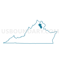
Outline

Summary
| Unique Area Identifier | 681652 |
| Name | Leeds Voting District |
| County | Fauquier County |
| State | Virginia |
| Area (square miles) | 135.41 |
| Land Area (square miles) | 134.79 |
| Water Area (square miles) | 0.62 |
| % of Land Area | 99.54 |
| % of Water Area | 0.46 |
| Latitude of the Internal Point | 38.90011000 |
| Longtitude of the Internal Point | -77.96389720 |
Maps


Graphs
Select a template below for downloading or customizing gragh for Leeds Voting District, Fauquier County, Virginia


Neighbors
Neighoring Voting District (by Name) Neighboring Voting District on the Map
- Amissville Voting District, Rappahannock County, VA
- Chester Gap Voting District, Rappahannock County, VA
- East Shenandoah Voting District, Warren County, VA
- Flint Hill Voting District, Rappahannock County, VA
- Happy Creek Voting District, Warren County, VA
- Linden Voting District, Warren County, VA
- Marshall Voting District, Fauquier County, VA
- Millwood Voting District, Clarke County, VA
- St. Louis Voting District, Loudoun County, VA
- The Plains Voting District, Fauquier County, VA
- Waterloo Voting District, Fauquier County, VA
- White Post Voting District, Clarke County, VA
Top 10 Neighboring County Subdivision (by Population) Neighboring County Subdivision on the Map
- Blue Ridge district, Loudoun County, VA (30,989)
- Marshall district, Fauquier County, VA (12,294)
- Scott district, Fauquier County, VA (12,152)
- Happy Creek district, Warren County, VA (9,530)
- Shenandoah district, Warren County, VA (8,448)
- Millwood district, Clarke County, VA (2,624)
- White Post district, Clarke County, VA (2,616)
- Jackson district, Rappahannock County, VA (1,597)
- Wakefield district, Rappahannock County, VA (1,536)
Top 10 Neighboring Place (by Population) Neighboring Place on the Map
Top 10 Neighboring Unified School District (by Population) Neighboring Unified School District on the Map
- Loudoun County Public Schools, VA (312,311)
- Fauquier County Public Schools, VA (65,203)
- Warren County Public Schools, VA (37,575)
- Clarke County Public Schools, VA (14,034)
- Rappahannock County Public Schools, VA (7,373)
Top 10 Neighboring State Legislative District Lower Chamber (by Population) Neighboring State Legislative District Lower Chamber on the Map
- State House District 33, VA (113,100)
- State House District 18, VA (82,817)
- State House District 15, VA (78,102)
Top 10 Neighboring State Legislative District Upper Chamber (by Population) Neighboring State Legislative District Upper Chamber on the Map
Top 10 Neighboring 111th Congressional District (by Population) Neighboring 111th Congressional District on the Map
- Congressional District 10, VA (869,437)
- Congressional District 1, VA (786,237)
- Congressional District 7, VA (757,917)
Top 10 Neighboring Census Tract (by Population) Neighboring Census Tract on the Map
- Census Tract 201, Warren County, VA (7,981)
- Census Tract 6108, Loudoun County, VA (5,940)
- Census Tract 9301, Fauquier County, VA (5,551)
- Census Tract 9502, Rappahannock County, VA (4,681)
- Census Tract 9302.04, Fauquier County, VA (3,367)
- Census Tract 206.02, Warren County, VA (2,886)
- Census Tract 9302.03, Fauquier County, VA (2,702)
- Census Tract 9501, Rappahannock County, VA (2,692)
- Census Tract 103, Clarke County, VA (2,661)
Top 10 Neighboring 5-Digit ZIP Code Tabulation Area (by Population) Neighboring 5-Digit ZIP Code Tabulation Area on the Map
- 22630, VA (30,292)
- 20115, VA (5,838)
- 20106, VA (5,142)
- 22642, VA (4,414)
- 22620, VA (2,348)
- 20144, VA (1,012)
- 20184, VA (839)
- 22627, VA (637)
- 22639, VA (560)
- 22640, VA (532)